Project Description
The city of Delhi is slated to be one of the largest urban agglomerations in the world in the near future with a projected population of 230 lakhs in 2021. The vision of the Delhi Master Plan 2021 is to make the city a global metropolis and a world-class city. All citizens would live and work in a sustainable environment and be assured of a better quality of life than the previous generation. Due to the peculiar geographic location of the Union Territory of Delhi, hemmed in between the states of Haryana and Uttar Pradesh, there is limited land availability for urban development. There is also an urgent need to protect parcels of land identified as agricultural/ rural and green for the better environmental health of the city.
Therefore, along with a limited physical expansion, the Master Plan for Delhi 2021 proposes to increase the population holding capacity of the existing urban limits through:
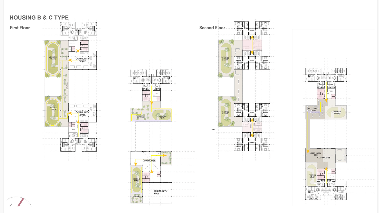
✔ Careful mix of housing typologies to ensure optimization of FAR as well as residential density.
✔ Re-densification of low-density areas in zones A to H developed during the earlier master plan periods by enhancing existing FAR by 50%
✔ Encourage mixed-use development to reduce travel trips and pressure on transport networks, to improve the quality of life of citizens by creating sustainable neighbourhoods.
✔ Encourage land pooling wherein individually owned parcels of land will be legally consolidated and transferred to a land pooling agency. Post-development the agency will transfer parts of the land to the owners.
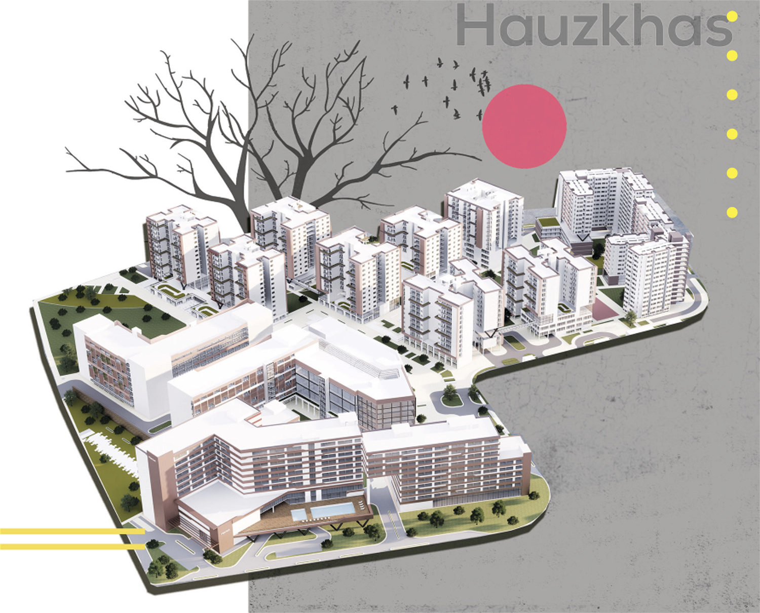
Redevelopment of Market precincts of Hauzkhas

What is Urban Design?
Urban design is concerned with the arrangement, appearance and function of our suburbs, towns and cities. It is both a process and an outcome of creating localities in which people live, engage with each other, and engage with the physical place around them.
 
notion image
Hauz Khas developed by DLF prior to 1957, is today an affluent colony in South Delhi, its heart being the historic Hauz Khas Complex. Hauz Khas is named after an ancient water reservoir by the same name, now part of the extensive Hauz Khas Complex. Comprising of 17 blocks of plotted housing, interspersed with plots for markets, schools, institutions etc., Hauz Khas is part of South Delhi district. E block market is the largest market and it lies in the middle of the colony. G block market and Aurobindo market are other markets close by.
 
The site is located on Aurobindo Marg which connects Ring Road to Outer Ring Road. The prominent landmarks nearby are the Hauz Khas deer park, Hauz Khas complex, Yusuf Sarai market, All India Institute of Medical Sciences and Safdarjung hospital. The nearest Metro station is Hauz Khas on the Magenta line.
Immediately outside the identified area of development is the Nili masjid, Maa Sarada Park, Hauz Khas police station, Hauz Khas church, National Institute of Public Cooperation and Child Development the modern Indian architectural icon of the 80’s the National Cooperative Development Corporation. Within the area demarcated for development, in addition to the two markets and plotted housing there are the Hanuman Mandir, the Geeta Bhawan, the Believers Eastern church and a sub post office.
notion image
notion image
 
Integration and Segregation
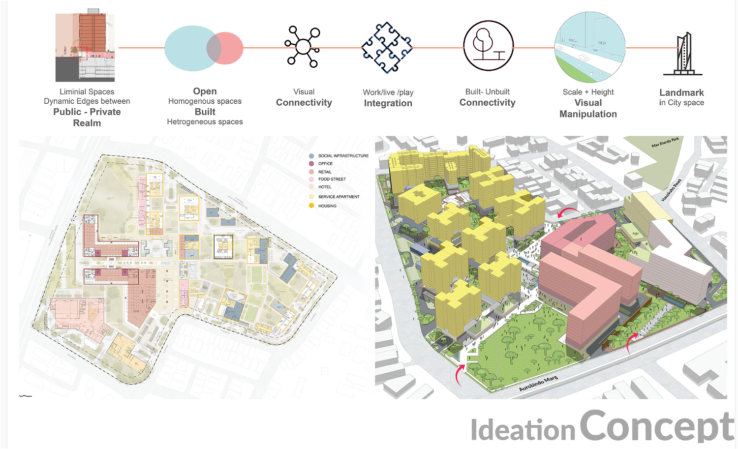
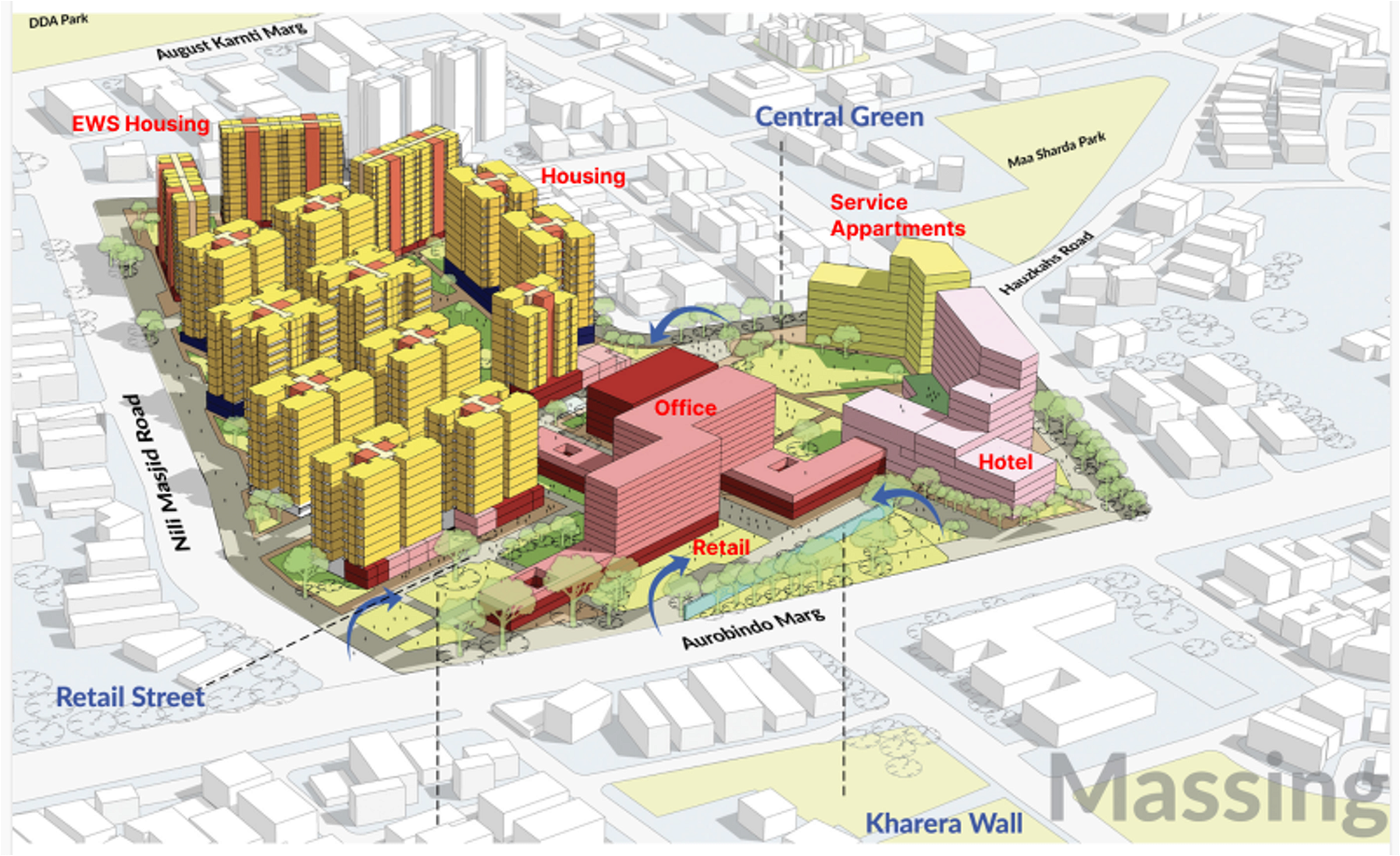
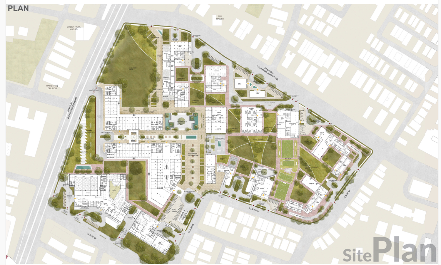
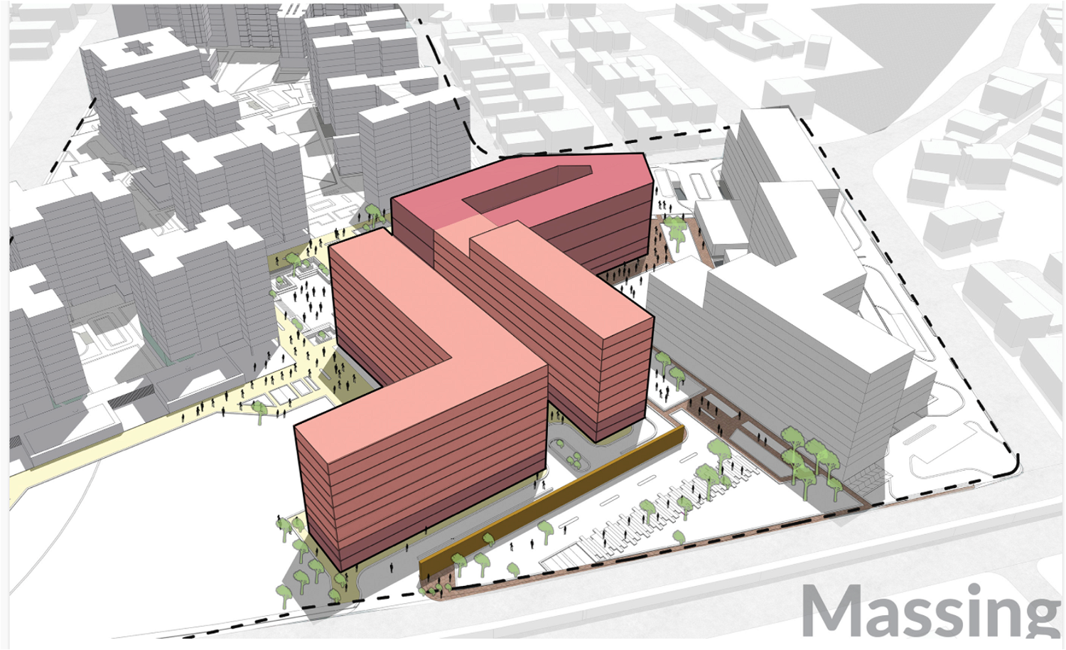
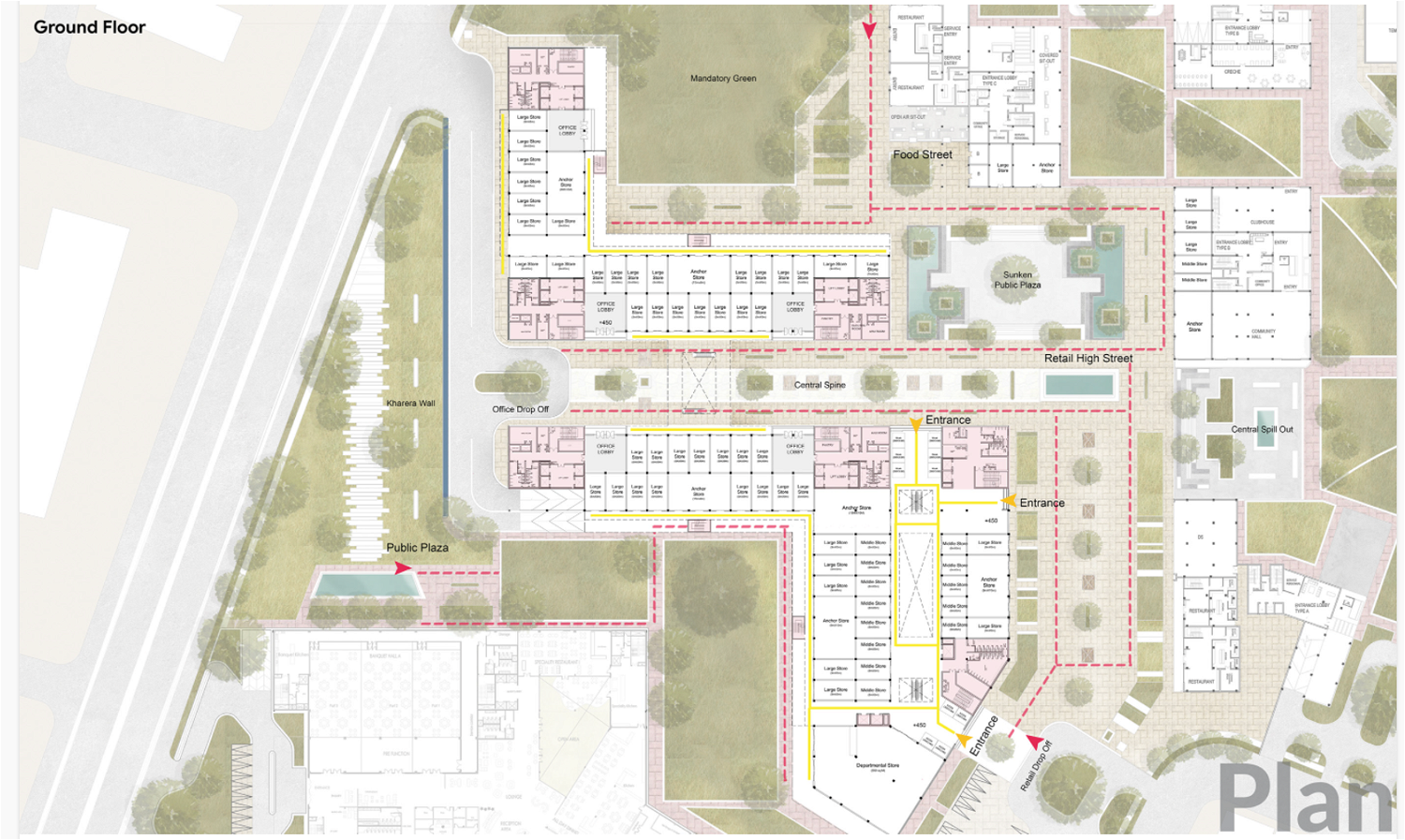
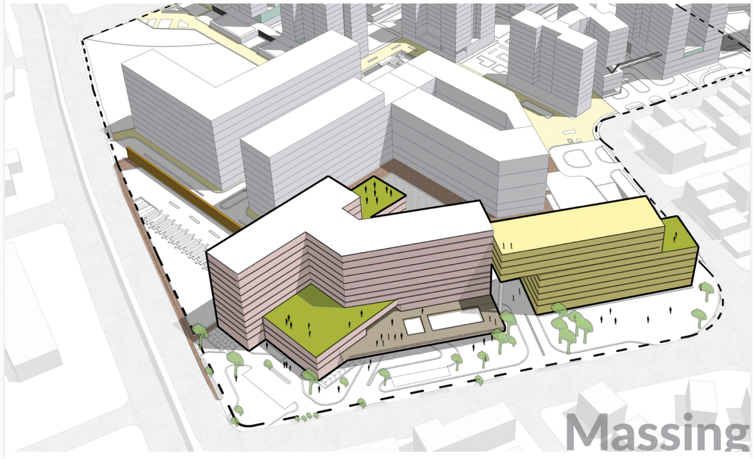
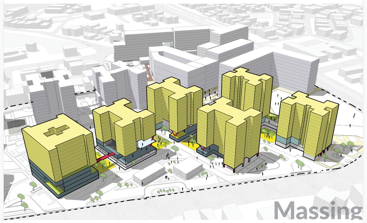
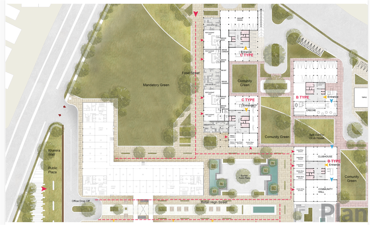
The central part of the site is utilised as the core pedestrian area, housing retail activities making it an active area throughout the hours.
 
Street Character
Extending the 1 hectare green to edges of the site rather than consolidating it to the centre, so as to draw in more pedestrians.
 
Interconnected Greens
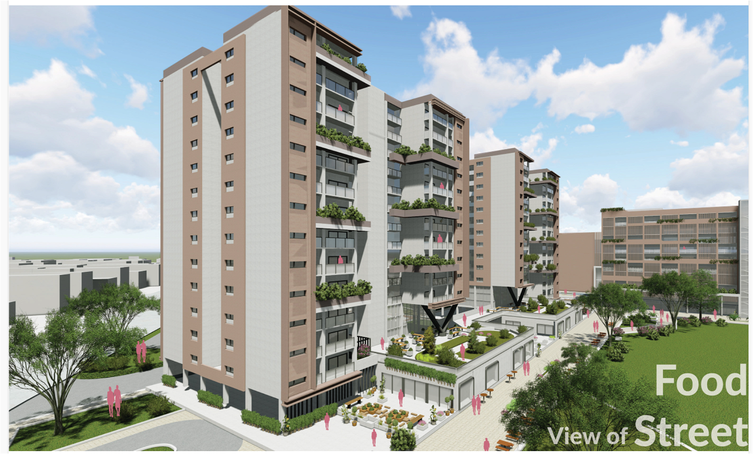
Retail facilities open to greens which make these greens suitable fro placing informal kiosks and eateries.
 
 
notion image
notion image
 
notion image
notion image
 

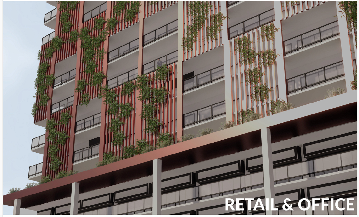
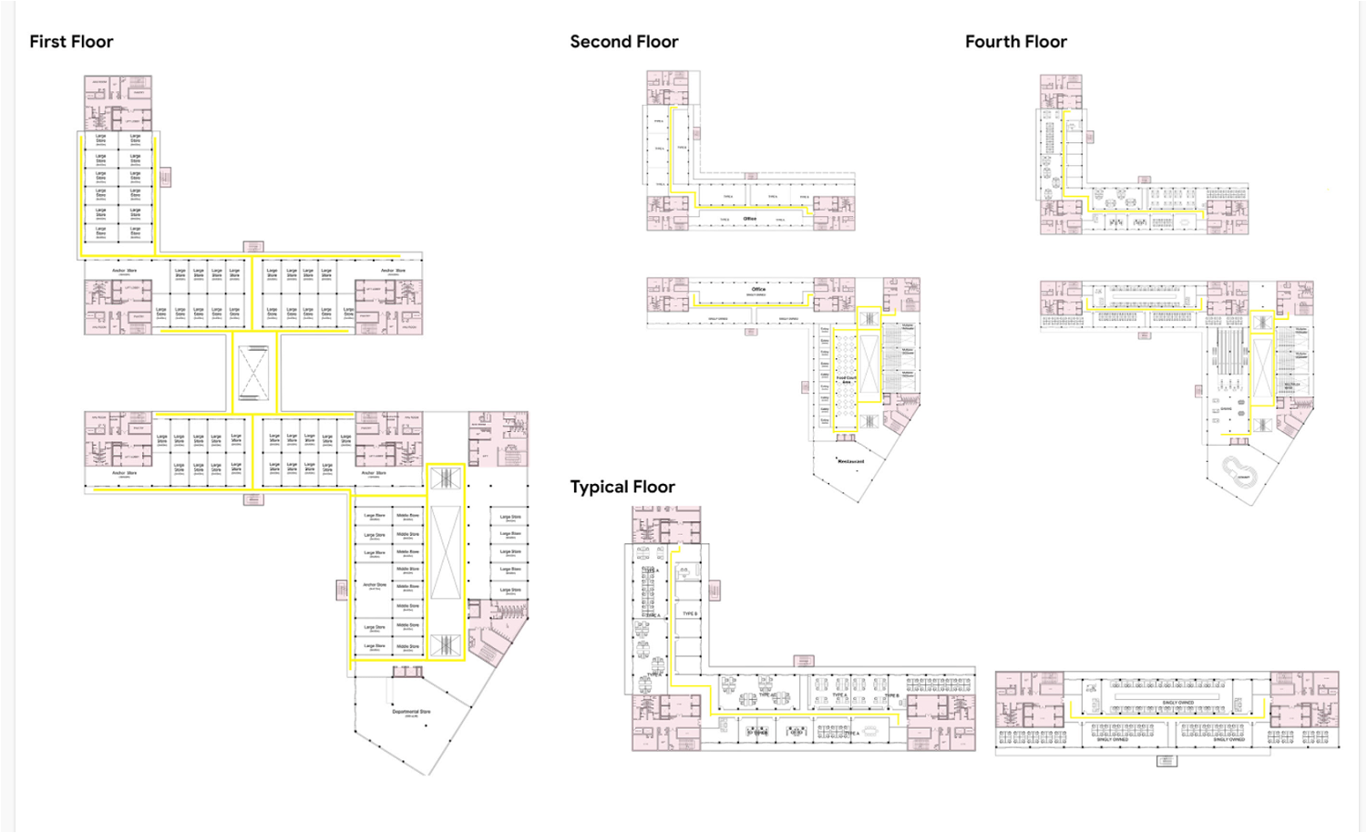
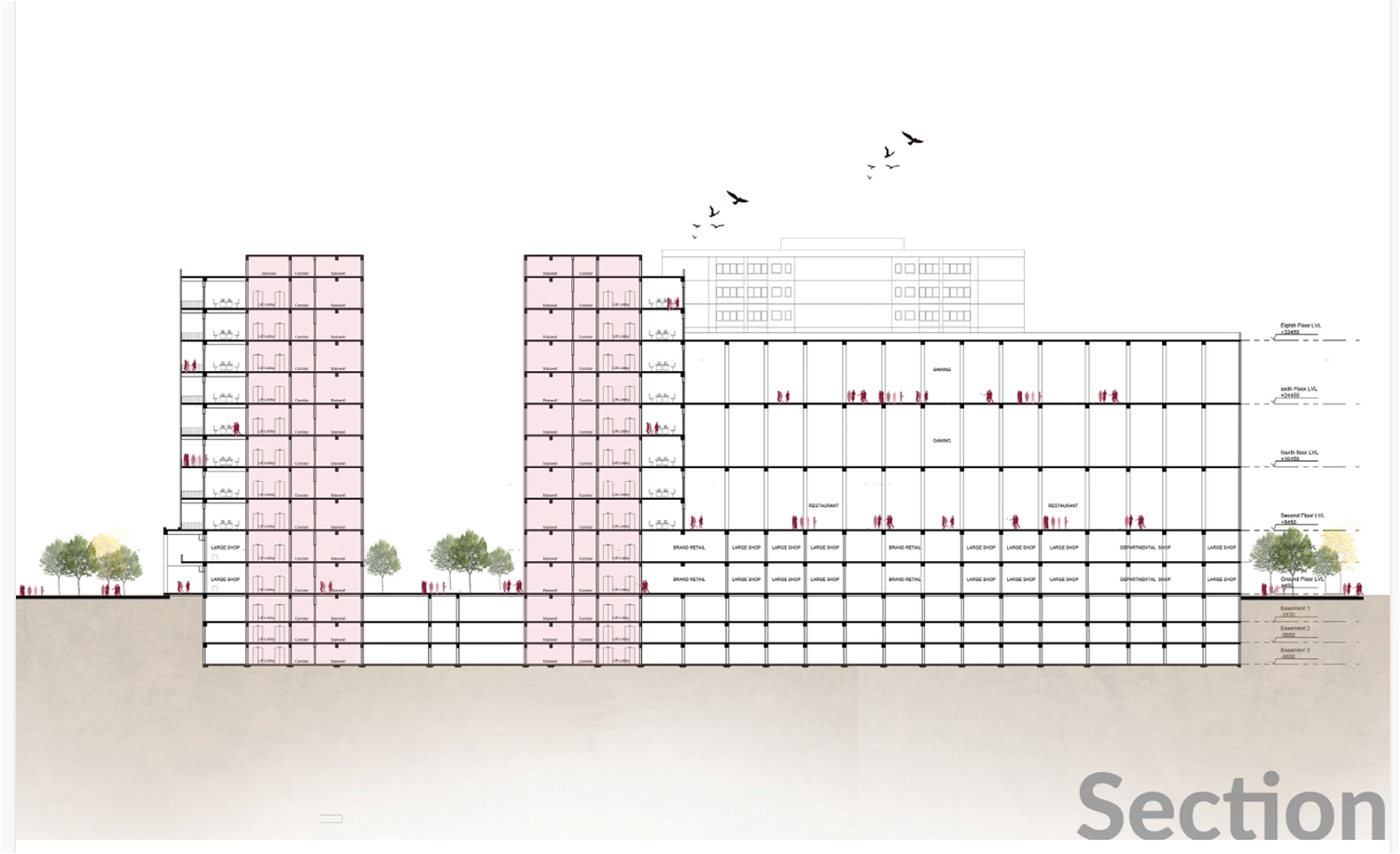
Retail and Office

notion image
notion image
notion image
notion image
notion image

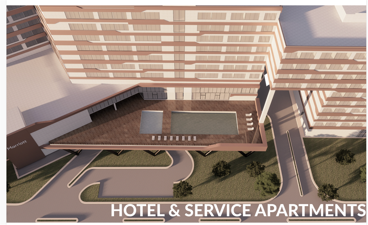
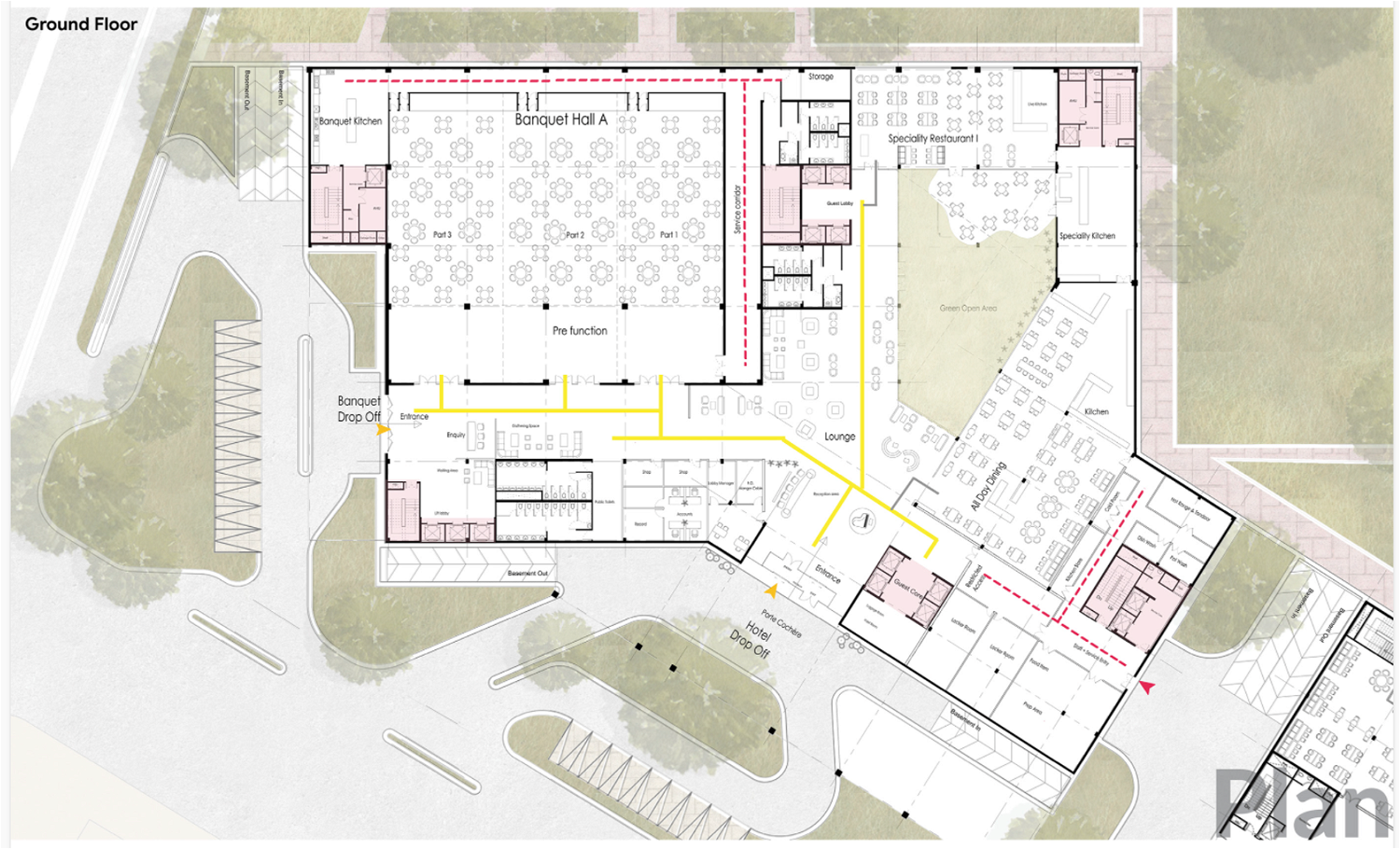
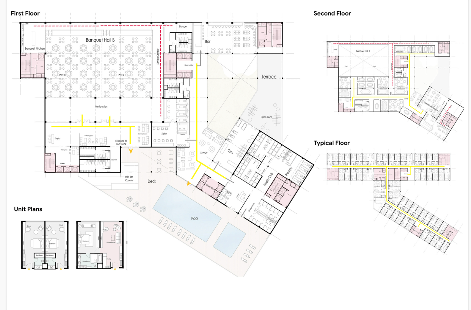
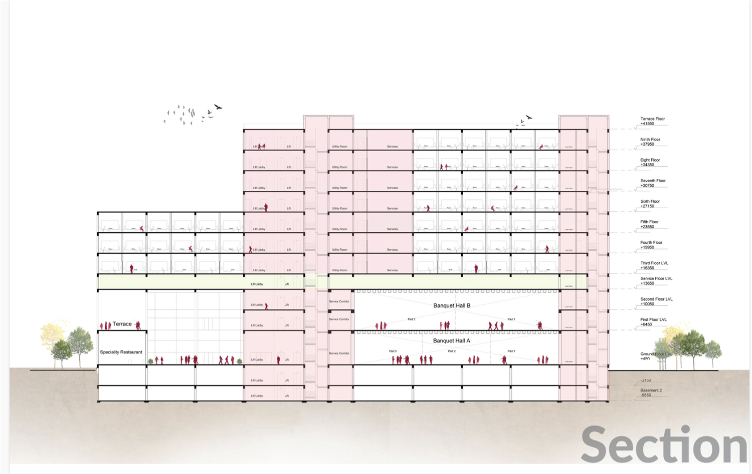
Hotel & Service Apartments

notion image
notion image
 
notion image
notion image
notion image
badge